Ground Penetrating Radar (GPR)
Key Applications
Geological studies
Archaeological investigations
Utility detection
Geotechnical assessment
See the Subsurface in High Resolution—Without Excavation
Ground Penetrating Radar (GPR) is a non-invasive geophysical survey method that uses high-frequency electromagnetic waves to image the shallow subsurface with exceptional resolution.
At GeophysicsPro, we apply GPR to deliver detailed near-surface imaging, supporting infrastructure development, utility detection, and geotechnical investigation with minimal disruption.
👉 Request a consultation for GPR survey services
Why Use GPR for Subsurface Investigation?
High-resolution imaging of shallow subsurface features
Non-destructive and rapid data acquisition
Ideal for urban and built environments
Detects utilities, voids, and buried objects
Provides real-time subsurface insight
GPR is particularly effective where detailed, shallow imaging is required.
Key Applications of GPR Surveys
Utility Detection & Mapping
Detection of buried pipes and cables
Utility corridor mapping
Verification of underground infrastructure
Infrastructure & Construction
Concrete scanning (rebar, post-tension cables)
Void detection beneath roads and slabs
Pavement and bridge deck assessment
Pre-drilling and excavation safety
Geotechnical Investigation
Shallow subsurface profiling
Detection of cavities and weak zones
Mapping of stratigraphic features
Environmental & Archaeological Studies
Buried object detection
Site characterization without excavation
Shallow stratigraphy mapping
How Ground Penetrating Radar (GPR) Works
GPR transmits high-frequency electromagnetic waves into the ground. When these waves encounter contrasts in material properties (dielectric permittivity), part of the energy is reflected back and recorded.
Strong reflections → material contrasts (e.g., pipes, voids)
Weak reflections → uniform materials
Depth of investigation depends on:
Soil conditions (clay reduces penetration)
Antenna frequency (higher frequency = higher resolution, lower depth)
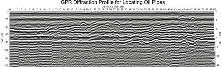
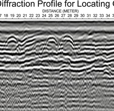
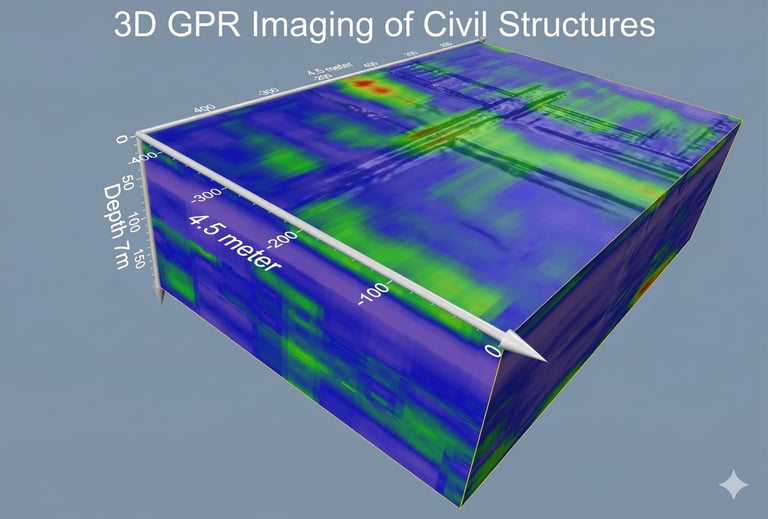
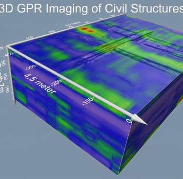
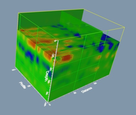
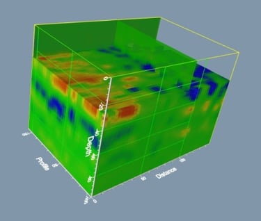
GPR Data Interpretation
GPR data is typically presented as radargrams, where subsurface features appear as characteristic patterns:
Hyperbolas → buried objects (pipes, cables)
Continuous reflectors → layer boundaries
Signal attenuation → conductive materials (e.g., clay, water)
Interpretation focuses on:
Identifying object location and depth
Mapping subsurface features
Assessing anomalies and potential risks
Integrated Use with Other Geophysical Methods
GPR is most powerful when combined with other methods:
ERT → deeper subsurface and groundwater conditions
MASW → soil stiffness and engineering properties
👉 GPR provides high-resolution shallow detail, complementing deeper geophysical methods.
Our Workflow for GPR Surveys
1. Survey Design
Define investigation objectives
Select appropriate antenna frequency
Plan survey grid or profile lines
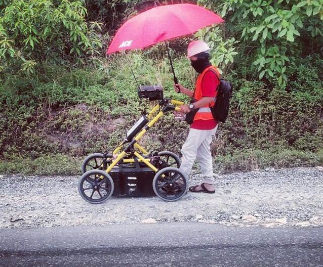
2. Data Acquisition
High-frequency GPR systems
Real-time data collection
Accurate positioning and coverage
Equipment & Technology
We utilize modern GPR systems with:
Multiple antenna frequencies for different depths
High-resolution data acquisition
Real-time visualization in the field
3. Data Processing
Signal filtering and noise reduction
Gain adjustments and time-depth conversion
Enhancement of subsurface reflections
4. Interpretation
Identification of utilities and anomalies
Depth estimation and mapping
Integration with site information
5. Deliverables
Processed radargrams
Annotated subsurface profiles
Utility and anomaly maps
Technical report with interpretation
Applications in Real Projects
Mapping underground utilities in urban environments
Detecting voids beneath roads and foundations
Concrete structure assessment
Supporting safe excavation and drilling
Limitations and Considerations
GPR performance depends on ground conditions:
Clay-rich soils reduce penetration depth
High moisture content may attenuate signals
Depth is typically limited to a few meters
👉 For deeper investigation, GPR is often combined with ERT or seismic methods.
Value to Your Project
Our GPR services provide:
Rapid and non-invasive subsurface imaging
Improved safety during excavation
Accurate utility mapping
Reduced risk of unexpected subsurface conditions
Cost-effective site investigation
Why Choose GeophysicsPro
Strong expertise in high-resolution subsurface imaging
Integration with geotechnical and other geophysical methods
Experience in urban and complex environments
Focus on practical, decision-ready outputs
Flexible full-service and modular solutions
Frequently Asked Questions (FAQ)
What is GPR used for?
GPR is used for detecting buried objects, mapping utilities, and imaging shallow subsurface structures.
How deep can GPR detect?
Typically up to a few meters, depending on soil conditions and antenna frequency.
Can GPR detect plastic pipes?
Yes, if there is sufficient contrast with surrounding materials.
Is GPR suitable for all ground conditions?
No, highly conductive materials such as clay can limit penetration depth.
Start Your High-Resolution Subsurface Investigation
If your project requires detailed shallow subsurface imaging for utilities, infrastructure, or geotechnical assessment, our GPR survey services provide fast and reliable results.